Exploring Craters of the Moon

Visited August 2007

Helpful Tips

What to Bring

Hats to ward off the summer heat. Superglue to keep the hats on heads because if the wind stops blowing – and blowing hard – everyone and every thing in Idaho would fall over. I recommend sturdy walking shoes – you’ll do a lot of walking. Wear long pants to keep the sun off your legs and to ward off ticks. Bring plenty of water. Water is available at the visitor’s center, but not in the monument proper. If you plan on visiting caves, bring flashlights. Though Indian Tunnel is well-lit through its natural sunroof, there is one stretch where a light is handy for picking your way across the floor. And bring a camera. Take lots of pictures. We used a fairly basic digital camera, and were a little disappointed with the results – but it’s probably operator error, as we just got it. I’m going to do the dumb thing and use my 35mm camera as a backup on trips until we can get this digital thing right.

Notes

Definitely springtime, if you want to see the wildflowers and avoid daytime temperatures that often exceed 100 degrees Farenheit. Spring is also when wildflowers will be best in the Devil’s Orchard and along the half-mile trail to the Indian Tunnel. If you choose to visit in the summer, plan your trip for early morning or late afternoon and evening, when the hottest part of the day is over. Idaho’s long summer days mean daylight starts shortly before 5:30 a.m. and doesn’t wane until after 9:30 p.m. Fees: The National Park Service charges $10 per vehicle. This fee covers all occupants of your vehicle for seven consecutive days and allows entrance in the area. For motorcycles, the fee is $5, which is per person for seven consecutive days.

GPS-Friendly Address: 1266 Craters Loop Road Arco, ID 83213 United States

Location
Craters of the Moon National Monument and Preserve
Address/Coordinates
{43.44856236153351,-113.44077537138702}: 43.44856236153351, -113.44077537138702
Website
https://www.nps.gov/crmo/index.htm
E-mail
Phone
(208) 527-1300

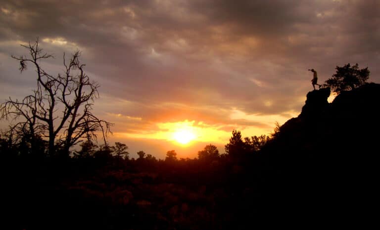
The landscape is sere, windblown, already in early May. Bare tree trunks, limbs broken, lay strewn like tumbleweeds. What trees live here are also wizened and twisted, limbs shaped by the wind into witchy fingers, Lugosi limbs, Lorre wrinkles, lithe, bony spaghetti. But thrusting from rock, sprouting from soil black with ancient ash, scampering or erupting from place to place, is life.

Minute pink flowers, faces like gibbons, wave gently in the breeze, roots finding moisture in the soil, spiky leaves slowing evaporation. Beetles, shiny black obsidian backs, crawl over pebbles of pumice and past fragrant boughs of sage brush. Kestrels wheel and scream overhead. Thumb-sized chipmunks race, dart into crevices in the rocks, snake into cracks, or blend into the bubbled rock to watch lanky, sunburned people, clamping hats to their heads in the strong wind, wander the eerie, cindered pocket of earth called Craters of the Moon National Monument and Preserve.

A sizable pocket it is. The monument and preserve cover 1,117 square miles – twice the area covered by the city of Phoenix, three times the size of Los Angeles, four times the size of New York City. Between 15,000 and 2,000 years ago, more than 25 volcanoes and spatter cones hurled and oozed out 618 square miles of lava flows, forming great lakes, rivers, fires, brume and smoke as the earth’s crust split open for 53 linear miles.

The lava buried sage brush deserts. The lava buried two rivers, forcing their intermittent springtime waters underground for more than 300 miles, to course out of the ground along the banks of Idaho’s Snake River at Thousand Springs. When it cooled, the lava and ash left behind towering cones, rivers of frozen rock, great basins where roofs caved in over drained underground lakes of lava, caves where lava once flowed, now populated by cool air, a rare cave-dwelling beetle and the cooing of mourning doves.

It’s a place for legends. The first eruptions, believe the Shoshoni Indians native to more hospitable climes to the south, were caused by an enormous serpent, angered by lighting, that wrapped itself around a mountain and squeezed until the fire inside came out and the mountain blew up.

It’s a place with stories. Early pioneers skirted what would become the monument in the late 1800s, following Goodale’s Cutoff, a segment of the Oregon Trail less prone to ambush by Shoshoni warriors. NASA astronauts trained in the monument under the tutelage of geologists, hoping to show these fighter pilots how to find and extract good rock samples in an alien environment.

It’s a poetic place. Robert Limbert, a trapper, taxidermist and wanderer, explored what would become the monument in 1924 and wrote of it for National Geographic: “It is the play of light at sunset across this lava that charms the spectator. It becomes a twisted, wavy sea. In the moonlight its glazed surface has a silvery sheen. With changing conditions of light and air, it varies also, even while one stands and watches. It is a place of color and silence.”

And a windy place. As we explored the monument’s developed area – following a 7-mile loop road and developed trails – we spent a lot of time chasing wind-blown hats. But our children, who despair at hour-long wanderings through the grocery store, tore up and down trails for hours searching for flowers, climbing steep spatter cones and shrieking with delight when chipmunks shot across the trails in front of them or climbed on nearby rocks.

The monument’s 7-mile loop road is thoughtfully set up to show off the area’s wildlife, foliage and features. We spent about four hours in the monument, but didn’t see everything. We stopped first at the Devils Orchard Nature Trail, a half-mile loop trail through cinders, bristlecone pine – both alive and dead – lava bombs and fragments and the park’s famed wild flowers. Unfortunately, a dry winter followed by an even drier spring meant the famed flowers were not in full force. We did find a few monkey flowers – tiny, bright pink blossoms, some growing right out of the rocks themselves, along with syringa and Indian paintbrush. Plenty of sage brush, of course. This would be a magnificent place to visit after a good rain shower – when the sage brush, soaking up moisture, scents the air with that tang that always makes me think of home.

The road from the visitor’s center to Devils Orchard wraps around two of the monument’s 25 volcanoes – 6,107-ft-fall Paisley Cone and 6,244 ft North Crater. Those volcanoes – and others, starting with 6,410-ft Sunset Crater, visible from US Highway 26 just north of the visitor’s center, form a line of cones and craters along the Great Rift, a 53-mile-long crack in the Earth’s surface that in places is 800 feet deep. As lava far below the Earth’s crust found this weak spot, it welled and burst to the surface, creating lava flows some of them 30 miles long.

For a peek inside some of the smaller cones, we stopped at the Spatter Cones and Big Craters Area. Drawn like moths to the flame, our three kids – ages 7, 5 and 2 ½ – shot immediately up the asphalt trail up the side of Spatter Cone, a volcanic pimple rising about 75 feet above the surrounding plain. Nearby, a shorter vent is called Snow Cone – and for a good reason. In its narrow crater, peppered with fallen rock, lies a snowdrift that rangers tell us lasts long into the summer – sometimes without melting, depending on the weather – because the rock and the cone’s narrow opening keeps the cold concentrated for months. In the midst of the ash of Earth’s fire, a little ice.

Since we have the kids with us, we opt not to take the 3-mile trail that loops through the monument’s Big Craters area – we’ve still got lots to see. Snow Cone and Spatter Cone perch on the edge of a massive sink hole and the Great Rift beyond, offering a view of frozen lava flows, bombs and pillars pretty much bereft of plant life. In the distance to the east you’ll see Big Southern Butte, one of five enormous volcanoes that dot the Snake River Plan from Craters of the Moon to Rexburg, 100 miles away as the kestrel flies. The butte - a combination of two volcanic domes – rises 2,500 feet above the surrounding plain. Compared to the flows and cones at craters, Big Southern Butte is ancient – about 300,000 years old – a testament to this area’s long volcanic history.

For a better view, climb nearby Inferno Cone, a steep mound of ash. We approached our next stop – the monument’s cave area – with some trepidation. A few weeks earlier, we took the kids to another lava cave, but didn’t get more than 30 feet past the entrance before the two youngest said they wouldn’t go any further, due to the dark. We hoped, however, to convince the kids that Indian Tunnel would be a lot friendlier. It is. The cave, 800 feet long and about 50 feet deep at its deepest part, is lit at intervals by sunlight pouring in through collapses and skylights in the ceiling. Our youngest didn’t hesitate at all. Once we got him down the metal staircase at the entrance, then down a staircase of natural rock to the cave floor, he disappeared, racing after his older brother. Our daughter, five, took a bit more convincing, but once we showed her the light coming in, she too scampered into the dark with the promise of light at the end.

The cave area offers four caves to explore. It’s a half-mile hike to the first cave – Dewdrop – over a rolling plain of lava flows, cracks, hummocks and sinks. Scattered among the rock are more wildflowers, including the bright red Indian paintbrush, which stands out against the black rock like fire. Dewdrop Cave is pretty much visible from the trail – it’s a small cave whose ceiling has completely collapsed.

Two other caves are clustered at the end of one trail fork: Boy Scout Cave and Beauty Cave. Both Boy Scout and Beauty Cave have narrow openings, and sections where you have to crawl on your belly – with hard hats and flashlights – to enter. Boy Scout Cave also has an ice floor covered with several inches of water. Too dangerous for kids. So we opted for the friendlier Indian Tunnel, which you can enter without flashlights. But because of its sheer size and varied lighting situations, Indian Tunnel is the best for people who want to explore a cave, take photos and have a good time with the kids. It’s also the largest and longest cave in the developed area’s cave complex.

The cave’s walls are surprisingly colorful, mottled with lichen where the sun shines through and with the colors common to volcanic rock: deep black, grey, rust, purple, and spots where the rock is as iridescent as a magpie’s black feathers. It’s also quite cool in the cave, even with the holes in the roof. The temperature offers a nice respite from the heat outside – on even this, a rather cool day, in the mid-70s.

There are two ways out of the cave – through the entrance, obviously, or at the other end. We opted to backtrack for a few reasons: It’s cooler inside the cave than on the 800-foot-long trail on the surface back to the main trail; and to get out on the end, you have to clambe over some rock falls and a few ledges, something we thought would be wise to avoid with three young children. But the surface trail does offer some good peeks into the cave through the skylights, and offers some interesting photo opportunities.

Our daughter – now a confirmed old cave hand – chatters the whole time about the rocks, the sunlight, the mourning doves cooing along the edges of one of the skylights where they’ve built their nests, and the absence of bats, bugs, wookalars and other assorted monsters. On the half-mile-long walk back to the parking area, she tells every hiker her story of the cave: “It’s the best cave ever! You can see because there’s lights in the roof! It’s cold inside, but there are NO bats!” She wanted us to spend the night in the cave. She wanted to come back to the cave the next day. We finally had to promise to take her back to the cave in “50 sleeps” – her estimate of a very long time – before she’d finally leave the cave.

Along the trail side, about fifty feet from Indian Tunnel’s entrance, are rings of lava rock the origin of which are only suspected, not known. The area’s earliest explorers found the rings, about ten feet in circumference. They and subsequent experts suspect the rings were put together by Native Americans who attached some religious or otherworldly significance to the area, or the tunnel. Looking over the expanse of frozen lava, rolling here and mounding there, as far as one can see, it’s easy to understand how someone could think this place is special.


About Uncharted
We are a group of explorers that were frustrated with the insane difficulty of finding essential information and resources for exploring the world's off-the-beaten-path locations and activities so we founded Uncharted. We exist to help you more easily explore whatever is uncharted to you.
Hometown: Logan, Utah, United States
Languages: Our team speaks the following languages: English, Spanish, Portuguese, Chinese.
Profile Photo

Helpful Tips

What to Bring

Hats to ward off the summer heat. Superglue to keep the hats on heads because if the wind stops blowing – and blowing hard – everyone and every thing in Idaho would fall over. I recommend sturdy walking shoes – you’ll do a lot of walking. Wear long pants to keep the sun off your legs and to ward off ticks. Bring plenty of water. Water is available at the visitor’s center, but not in the monument proper. If you plan on visiting caves, bring flashlights. Though Indian Tunnel is well-lit through its natural sunroof, there is one stretch where a light is handy for picking your way across the floor. And bring a camera. Take lots of pictures. We used a fairly basic digital camera, and were a little disappointed with the results – but it’s probably operator error, as we just got it. I’m going to do the dumb thing and use my 35mm camera as a backup on trips until we can get this digital thing right.

Notes

Definitely springtime, if you want to see the wildflowers and avoid daytime temperatures that often exceed 100 degrees Farenheit. Spring is also when wildflowers will be best in the Devil’s Orchard and along the half-mile trail to the Indian Tunnel. If you choose to visit in the summer, plan your trip for early morning or late afternoon and evening, when the hottest part of the day is over. Idaho’s long summer days mean daylight starts shortly before 5:30 a.m. and doesn’t wane until after 9:30 p.m. Fees: The National Park Service charges $10 per vehicle. This fee covers all occupants of your vehicle for seven consecutive days and allows entrance in the area. For motorcycles, the fee is $5, which is per person for seven consecutive days.

GPS-Friendly Address: 1266 Craters Loop Road Arco, ID 83213 United States

Exploring Craters of the Moon

Leave a Reply